-
25,00
USD
-
* Free shipping to US.
-
-
Not available
Features:
- Pages: 2
- Format: 19,6x9,5 cm
- Edition Date: 2017
- Language: Inglés.
- Binding: Tapa blanda o Bolsillo.
-
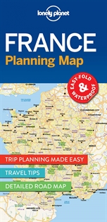
France Planning Map
-
9781786579065
-
-
-
-
-
-
Durable and waterproof, with a handy slipcase and an easy-fold format, Lonely Planet France Planning Map is your conveniently-sized passport to traveling with ease. Get more from your map and your trip with images and information about top country attractions, itinerary suggestions, a transport guide, planning information, themed lists and practical travel tips. • Durable and waterproof.• Easy-fold format and convenient size.• Handy slipcase.• Full colour and easy-to-use.• Before-you-go info.• Beautiful imagery.• Tailored itineraries.• Can’t-miss regional highlights.• Detailed town index.• Transport planner.• Themed lists. Coverage Includes: Paris, Champagne, Burgundy, Loire Valley, D-Day beaches, Brittany, Normandy, Bordeaux, Dordogne, Languedoc, Pyrenees, Marseille, Provence, French Riviera, Nice, Lyon, Grenoble, French Alps, Strasbourg, Colmar, Metz. Full Map Dimensions: 63.5 cm x 49.5 cm (25 in. x 19.5 in.)
-
25,00
USD
-
* Free shipping to US.
-
-
Not available
The book belongs to the following catalogs
Other books in the subject Guías De Viaje Y Turismo:
-
38,78
USD
-
43,58
USD
-
42,23
USD
-
30,15
USD
-
41,47
USD
-
27,69
USD